Postleitzahl 44107 - Hetauda, Entwicklungsregion Mitte (Nepal)
Entwicklungsregion Mitte (Nepal) | Nepal
| Primär-Stadt | Hetauda |
| Bevölkerung | 84,775 |
| Vorwahlen | 57 |
| Stadtviertel | Chaughada Bazar, Churiyamai, Kamane |
| Timezone | Nepal Time |
| Koordinaten | 27.424272510658486° / 85.03363210512462° |
| Verwandte Postleitzahlen | 44100, 44101, 44102, 44103, 44104, 44106, 44108, 44111, 44112, 44113 |
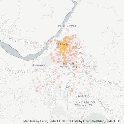
Karte von Postleitzahl 44107 - Hetauda, Entwicklungsregion Mitte (Nepal)
Interaktive Karte
Bevölkerungsdichte von Nepal
Bevölkerungsdichte: 194 / km²
| Standort | Bevölkerung | Gebiet | Dichte |
|---|---|---|---|
| Nepal | 28,7 million | 147.926,4 km² | 194 / km² |
Quellen: JRC (Gemeinsame Forschungsstelle der Europäischen Kommission) arbeitet an GHS built-up grid
Geschäftskonzentration in Postleitzahl 44107 - Hetauda, Entwicklungsregion Mitte (Nepal)
Branchen
Unternehmensverteilung nach Branche in Postleitzahl 44107 - Hetauda, Entwicklungsregion Mitte (Nepal)
| Branchenbeschreibung | Anzahl der Betriebe |
|---|---|
| Banken | 59 |
| Baumarkt | 78 |
| Bekleidungsladen | 124 |
| Einkaufen | 217 |
| Elektronikläden | 99 |
| Erziehung und Unterricht | 130 |
| Hotels und Motels | 91 |
| Lebensmittelläden und Supermärkte | 71 |
| Öffentliche Verwaltung | 124 |
| Restaurants | 157 |
CO2-Emissionen von Nepal
Kohlendioxid (CO2) -Emissionen pro Kopf in Tonnen pro Jahr
| Standort | CO2-Emissionen | CO2-Emissionen pro Kopf | Intensität der CO2-Emissionen |
|---|---|---|---|
| Nepal | 11,136,221 tn | 0.39 tn | 75.3 tons/km² |
Quellen: [Verknüpfung] Moran, D., Kanemoto K; Jiborn, M., Wood, R., Többen, J., and Seto, K.C. (2018) CO2-Fußabdruck von 13.000 Städten. Environmental Research Letters DOI: 10.1088/1748-9326/aac72a
CO2-Emissionen von Nepal
| CO2-Emissionen 2013 (Tonnen/Jahr) | 11,136,221 tn |
| CO2-Emissionen 2013 (Tonnen/Jahr) pro Kopf | 0.39 tn |
| CO2-Emissionsintensität 2013 (Tonnen/km²/Jahr) | 75.3 tons/km² |
Aktuelle Erdbeben in der Nähe
Magnitude 3.0 und höher
| Datum▼ | Zeit↕ | Magnitude↕ | Distance↕ | Tiefe↕ | Standort↕ | Verknüpfung |
|---|---|---|---|---|---|---|
| 5/17/19 | 1:23 AM | 4.7 | 64.5 km | 10,000 m | 37km NE of Bharatpur, Nepal | usgs.gov |
| 4/23/19 | 5:44 PM | 4.7 | 37.9 km | 27,340 m | 22km WNW of Kirtipur, Nepal | usgs.gov |
| 12/22/18 | 3:21 PM | 4.1 | 64.6 km | 10,000 m | 7km NNE of Nagarkot, Nepal | usgs.gov |
| 6/27/18 | 9:07 PM | 4.8 | 55.7 km | 10,000 m | 45km ENE of Bharatpur, Nepal | usgs.gov |
| 2/26/17 | 8:21 PM | 4.6 | 89 km | 20,280 m | 16km WNW of Ramechhap, Nepal | usgs.gov |
| 9/18/16 | 10:14 AM | 4.2 | 61.8 km | 25,200 m | 12km NNW of Nagarkot, Nepal | usgs.gov |
| 6/20/16 | 10:49 PM | 3.5 | 34.6 km | 10,000 m | 33km W of Kirtipur, Nepal | usgs.gov |
| 6/13/16 | 4:27 PM | 4.1 | 77.7 km | 10,000 m | 28km NNE of Bharatpur, Nepal | usgs.gov |
| 5/28/16 | 2:39 AM | 4.6 | 75.4 km | 10,000 m | 34km NNW of Nagarkot, Nepal | usgs.gov |
| 5/23/16 | 12:09 PM | 4.3 | 31.5 km | 10,000 m | 18km W of Kirtipur, Nepal | usgs.gov |
Anzeige von 1-10 von 255
…
Quelle: U.S. Geological Survey (USGS)
Primär-Stadt
Hetauda (Nepali: हेटौडा) ist eine Stadt und Verwaltungssitz des Distrikts Makwanpur in der Verwaltungszone Narayani im Süden von Nepal. liegt etwa 132 Straßenkilometer (40 km Luftlinie) südwestlich von Kathmandu. Die Stadt liegt auf einer Höhe von 463 m am Fl..
Hetauda Wikipedia-Seite